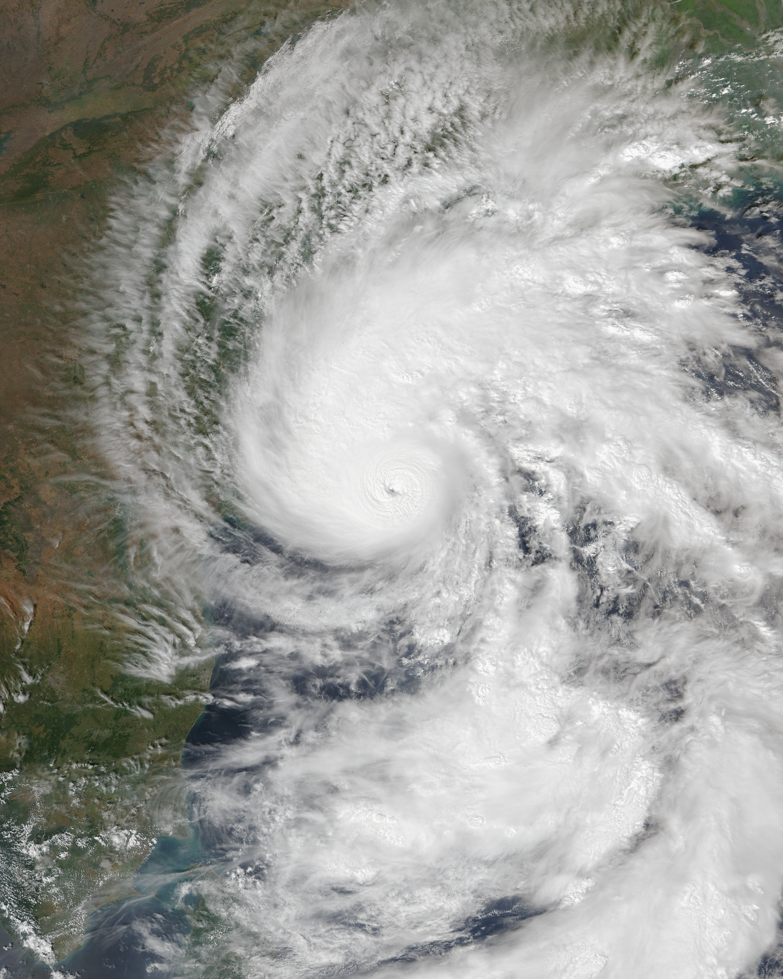
Photo: VIIRS imagery from NOAA's NOAA-21 satellite / Wikimedia Commons, public domain
Cyclone Arnab began crossing the Andhra Pradesh coast close to the south of Yanam in the early hours of Wednesday, October 28, bringing destructive winds, heavy rain and rough seas to a long stretch of the coastline. The India Meteorological Department (IMD) said the landfall process started at about 1.20 am, and by 5.30 am the very severe cyclonic storm was described as “practically stationary” along the coast, with the process expected to go on for another two to three hours.
A slow-moving storm hugging the coast
In its 5.30 am update, the IMD placed the centre of the storm about 30 km east of Narsapur, 45 km south-southwest of Yanam and 70 km south-southwest of Kakinada. The system was forecast to keep moving north-west and cross the coast between Bapatla and Visakhapatnam with sustained winds of up to 135 kmph and gusts touching 150 kmph. Its northern spiral band had already moved over land while the centre stayed very close to the shoreline.
State disaster management officials said gusts of 125 to 135 kmph were being recorded in Kakinada, Konaseema and West Godavari districts and were likely to persist for around three more hours. The Konaseema district collector asked residents to stay indoors until noon.
Trees down, power cut, roads and rail disrupted
Reports reaching the state control room described uprooted trees, fallen electricity poles, damaged roads, flooded low-lying areas and widespread power cuts from Srikakulam in the north to Bapatla in the south. Hundreds of poles were reported down in Kakinada and Konaseema, and several mobile towers lost power, leaving some areas without phone signal. Power had also been switched off in parts of the affected area as a precaution, officials told the chief minister.
In Yanam, a relief centre was itself flooded, and officials moved evacuees to the first floor. At Allavaram, seawater reached the compound wall of an ONGC facility. In Kakinada, police rescued four people trapped by floodwater and three night-shift staff stranded at port warehouses.
- 63 trains were cancelled and 15 rescheduled; the state road transport corporation cancelled 160 bus services in Visakhapatnam district.
- Traffic was disrupted on stretches of National Highway 16 between Kathipudi and Ongole, and night travel restrictions were imposed in several districts.
- Flights were badly hit, with all IndiGo services from Vijayawada cancelled for Wednesday.
- Kannuripalem in Anakapalli district recorded the highest rainfall, 261.5 mm, in the 24 hours up to 4 am, according to the IMD.
Relief effort and the toll so far
Chief Minister N. Chandrababu Naidu held a teleconference at 6.15 am and told officials to clear fallen trees and restore electricity as soon as the winds ease, and to guard against tanks and canals overflowing. The school education department has turned 609 schools into relief centres. Before landfall, Andhra Pradesh had moved about 90,000 people to safety and Odisha about 48,000, according to the two state governments. One death, of a man who came in contact with a snapped live wire in Visakhapatnam, was reported on Tuesday.
What happens next
Officials expect heavy rain over coastal Andhra Pradesh to continue on Wednesday and Thursday as the system moves further inland. The IMD has also warned of rain and strong winds in southern Odisha, Telangana, parts of Chhattisgarh, eastern Uttar Pradesh and Bihar. Damage assessments are expected once the winds subside and crews can reach cut-off villages.